Wales

Walking Dinas Head, Pembrokeshire

A short but stunning walk around the coastline of Dinas Head following the Wales Coast Path, with great views out to sea and of nesting seabirds, before returning via a flat, tarmac path through sheltered woodland.

Activity type: Walk (but it would also make a fun trail run)

Distance: 3 miles approximately

Elevation: 169 metres (554 feet) of climbing (see Strava elevation for full profile)

Accessibility: No styles, some sections are reasonably steep and have steps (see walk notes at the end for more info.)

Route type: Circular

Start/finish point: Car park at Cwm-yr-Eglwys, Pembrokeshire.

Click View on Strava to check out the route and download the GPX file of the walk here.

The steep road narrowed as we drove down into Cwm-yr-Eglwys, meaning Valley Church. The lane felt even more claustrophobic driving in late June as the hedgerow greenery leaned inwards until it touched the van on both sides. It reminded me a little of watching those Tour de France cyclists riding through an ever-narrowing tunnel of bodies on their exhausting Alpine ascents.

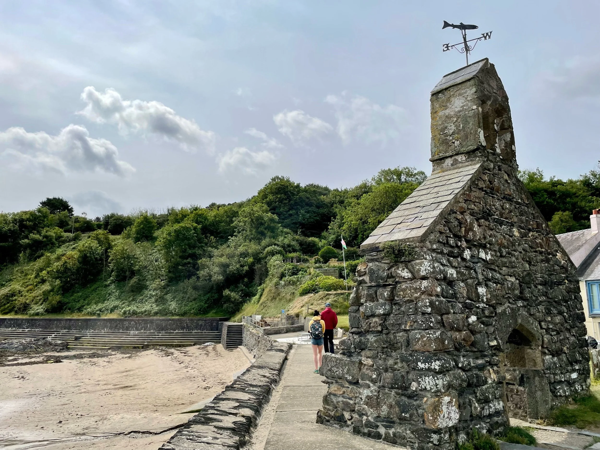
It was early on a Monday morning, still term time, so the car park was almost empty except for one or two cars. As soon as we stepped outside, two things immediately came to our attention, a cold wind whipping off the sea and what looked like some sort of monument. Or was it a church or chapel of some kind?

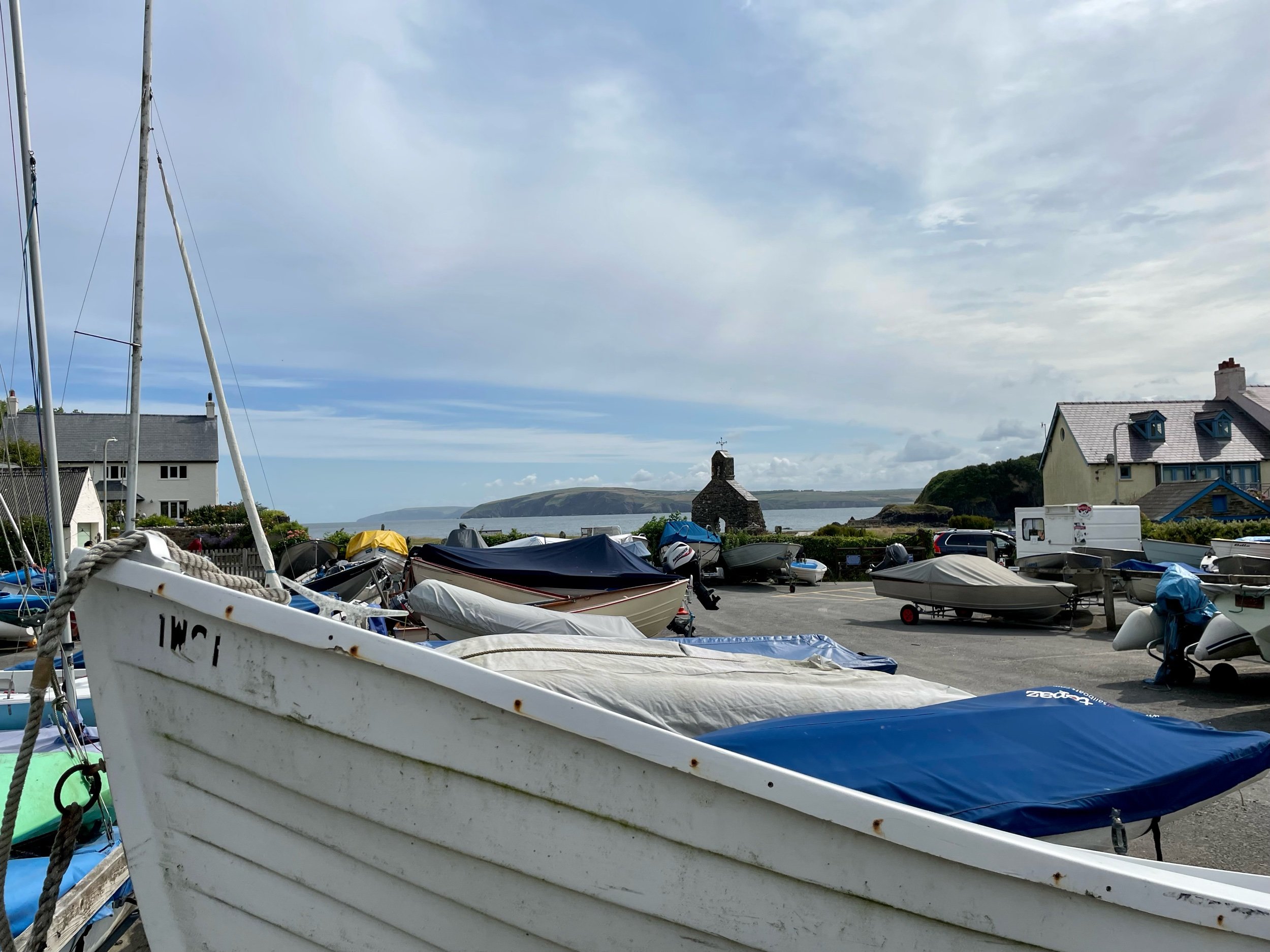
We donned a few extra layers – a shock to the system after such a warm day the day before – and dressed Lennie in his colourful new raincoat. Wandering past the inland boatyard with its small dinghies and the odd sailboat, the wind brought the familiar sounds of rippling cloth and the gentle clanging of buoy bells.

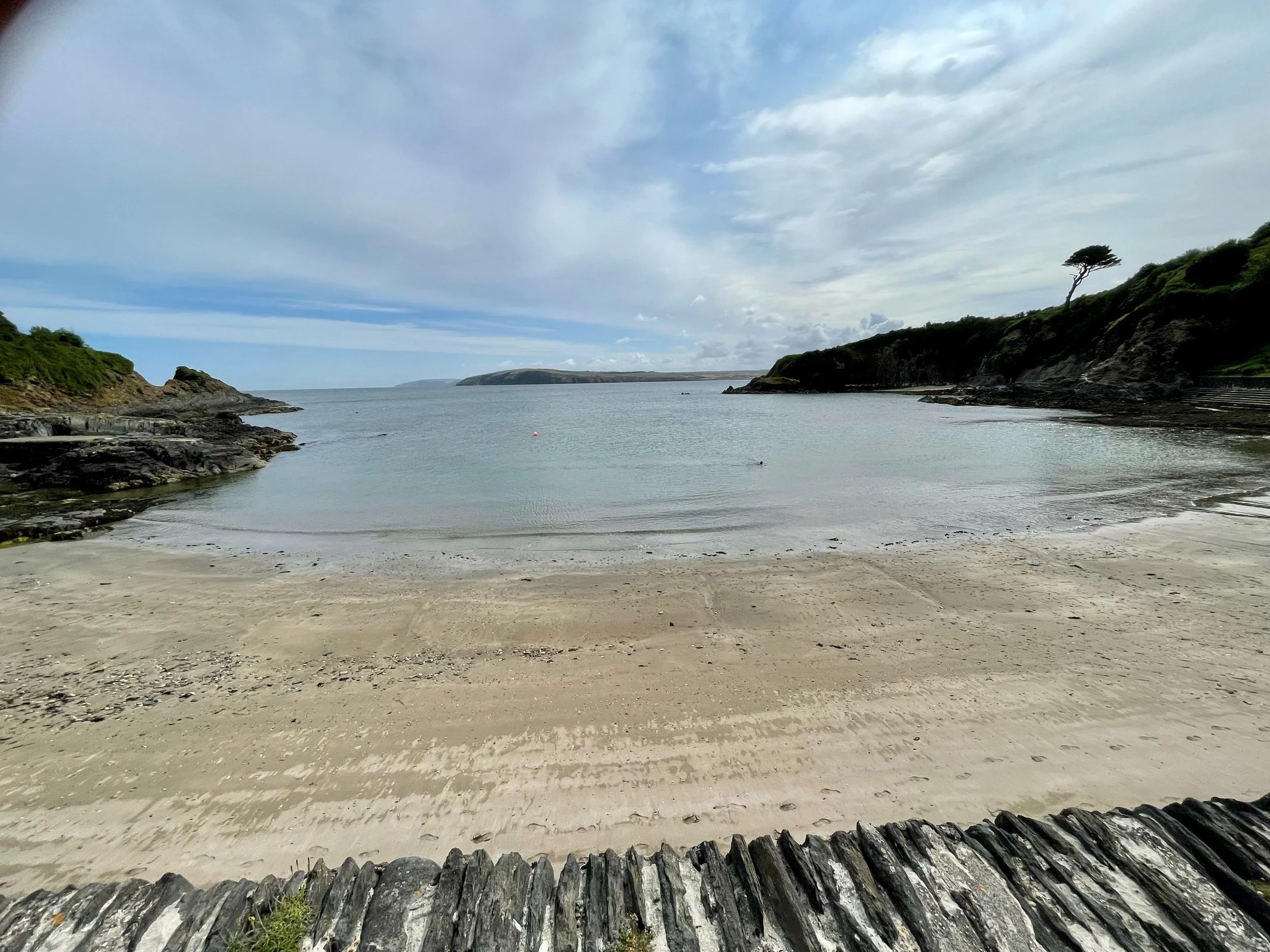
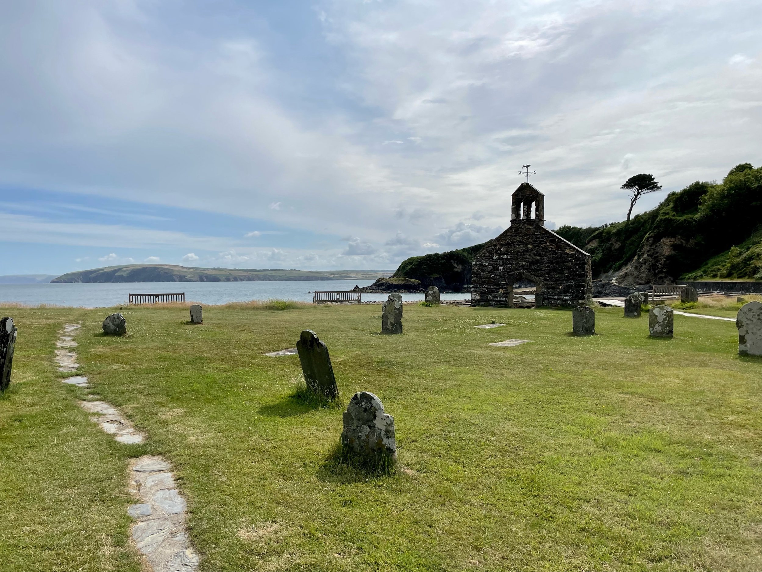
Behind the boats, a gate led us through into a graveyard and what was obviously then the remains of a small church, now just a single wall topped with a tiny belltower and weather vane. An information board informed us that this had once been St Brynach’s, a 12th-century church, but two storms in the mid-19th century had washed away firstly much of the graveyard and then, in the great Charter Storm of 1859, most of the church as well. Just a few feet beyond the church, a small stone wall separated it from a fabulous little beach, benches offering a tranquil spot to sit and stare out to sea from the tiny, rocky cove.

The scene was beautiful but also tinged with sadness, and the cold wind whipping in was a reminder that on worse days this narrow inlet would, and clearly had, acted as a funnel through which the wild weather reached the shore.

Reading up about the village, it seems many villagers abandoned the place after the great storm. In more recent times, the desire for holiday homes in picturesque spots such as this meant that only one or two of the houses were now owned by people who lived there. For all its sadness and challenges, it remained a place of unquestionable beauty.

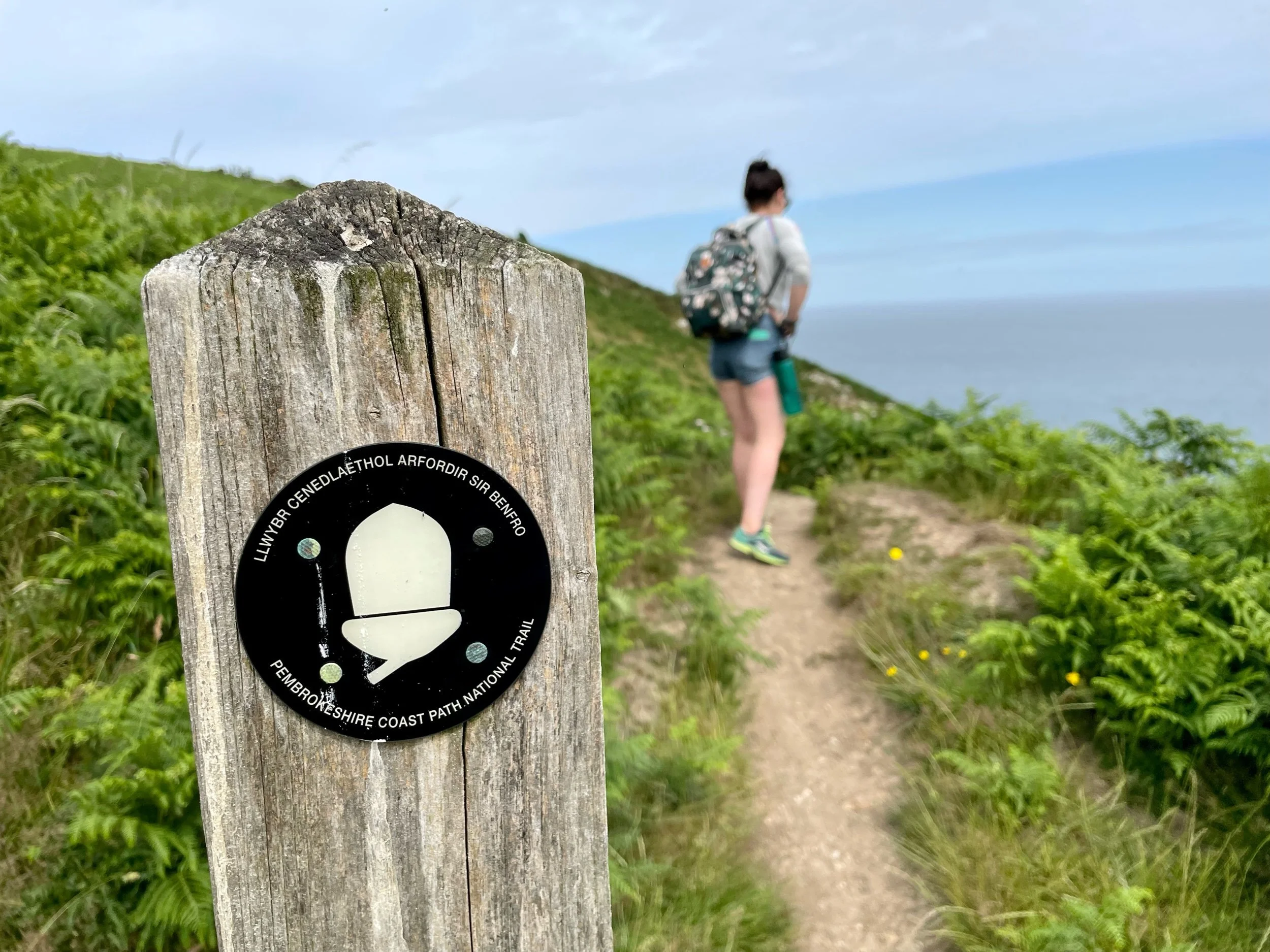
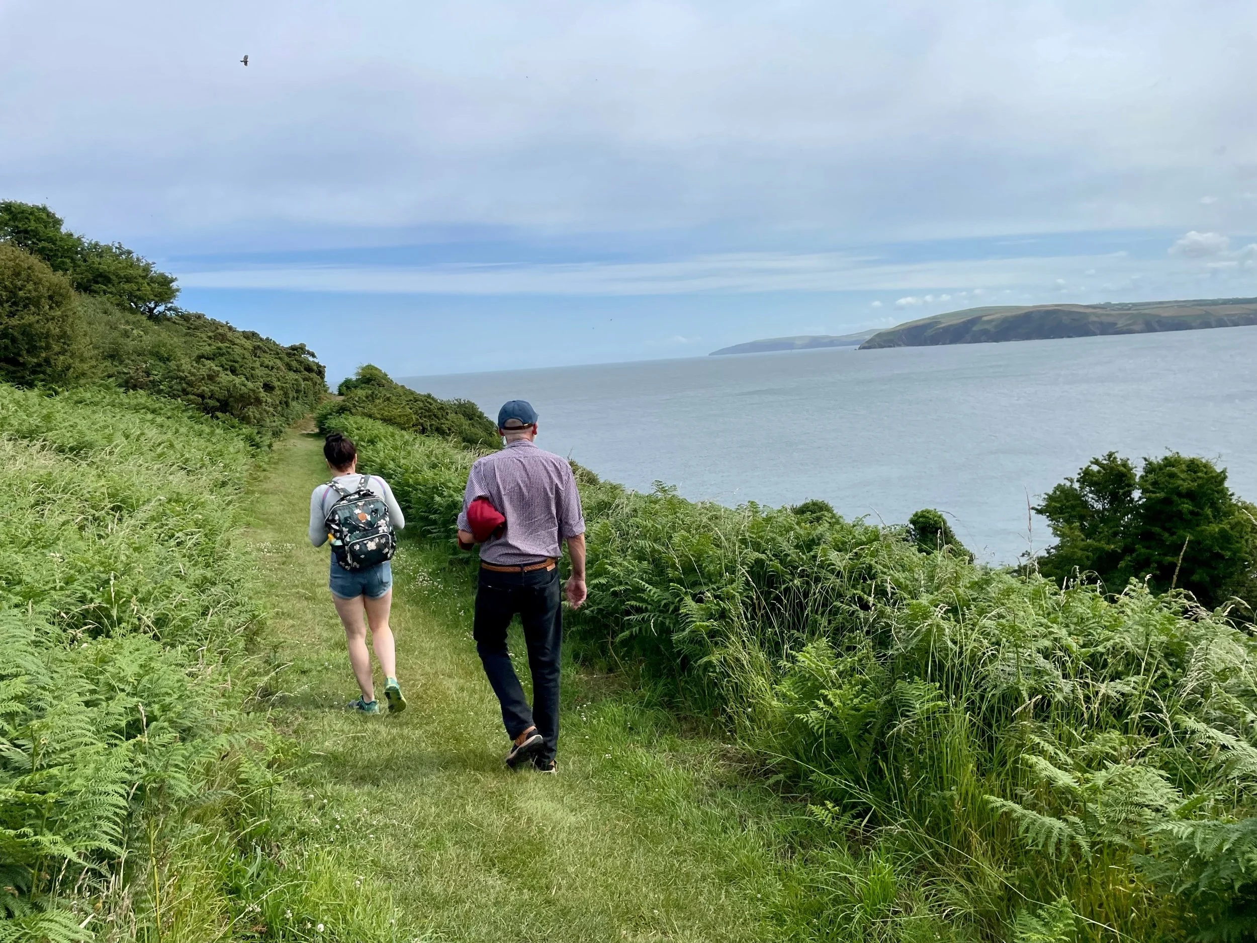
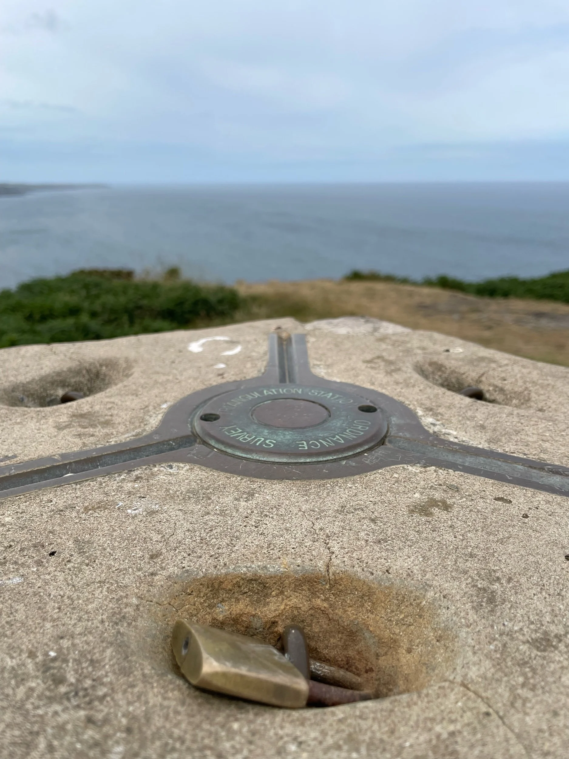
After exploring the church ruins, it was time to get going. The route was a fairly easy one, taking the Wales Coast Path up and all the way around the headland. All we need to do was look for the familiar acorn signs that you’ll find on all national trails and walk.

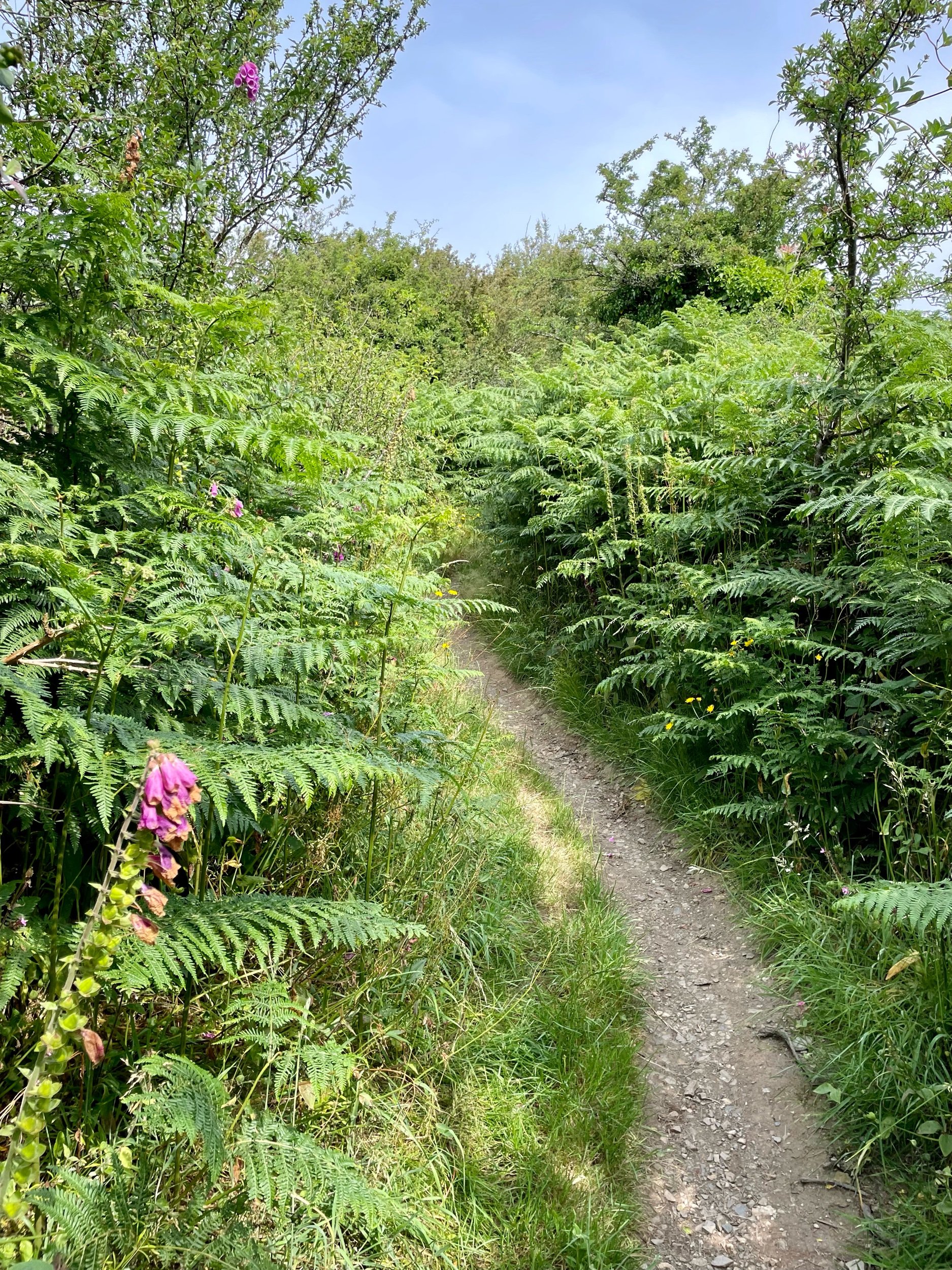
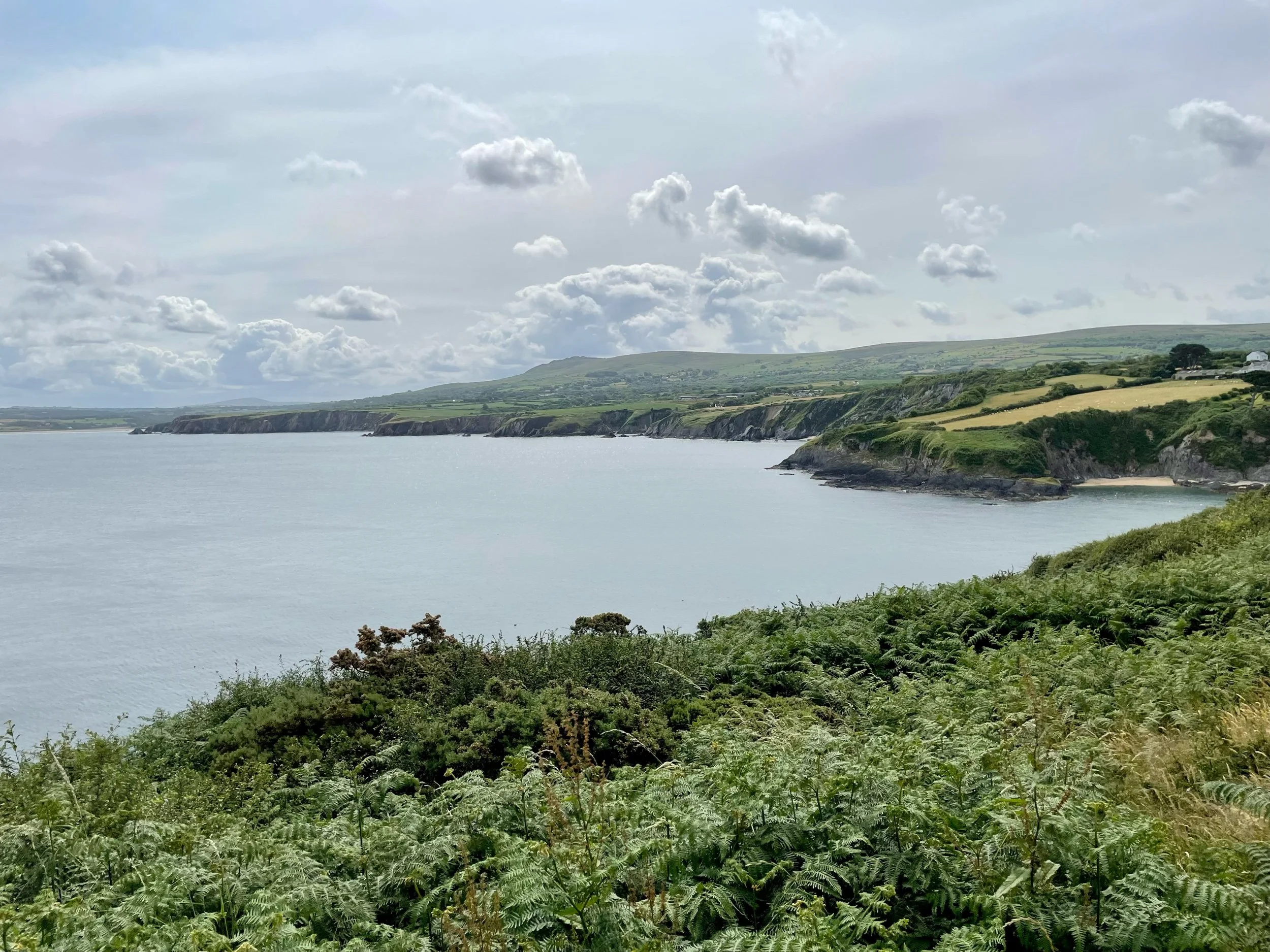
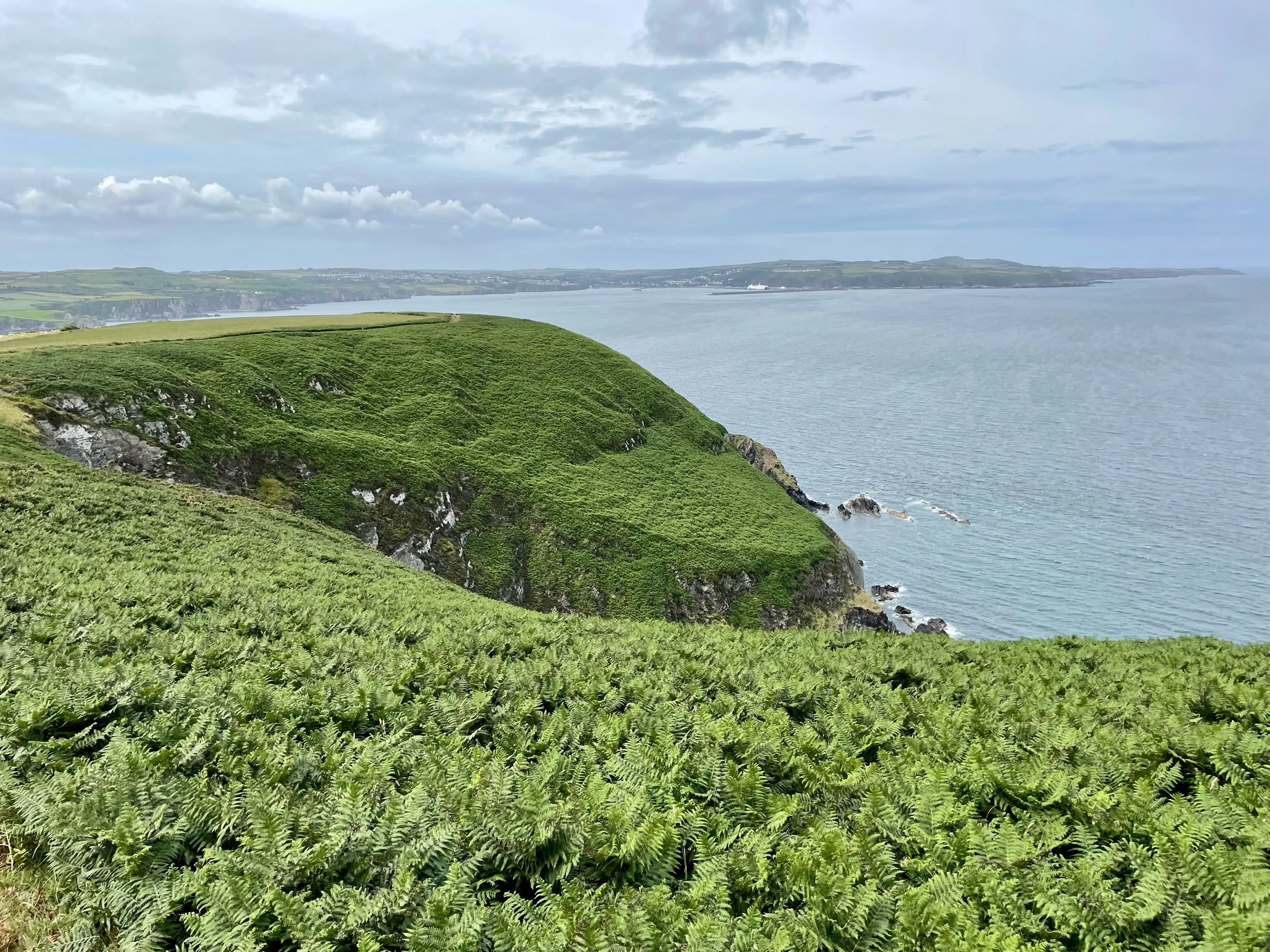
The climb started instantly as we left the village, weaving our way up through a sheltered gully with ferns higher than our heads lining the path on either side. Out of the wind and climbing continuously, we were soon too warm and the extra layers were quickly shed. Through gaps in the greenery we were treated to great views out beyond the cove to tiny, inaccessible beaches, the cliffs of the coastline snaking in and out into the distance, and beyond to the rugged hilltops of the Preseli Hills.

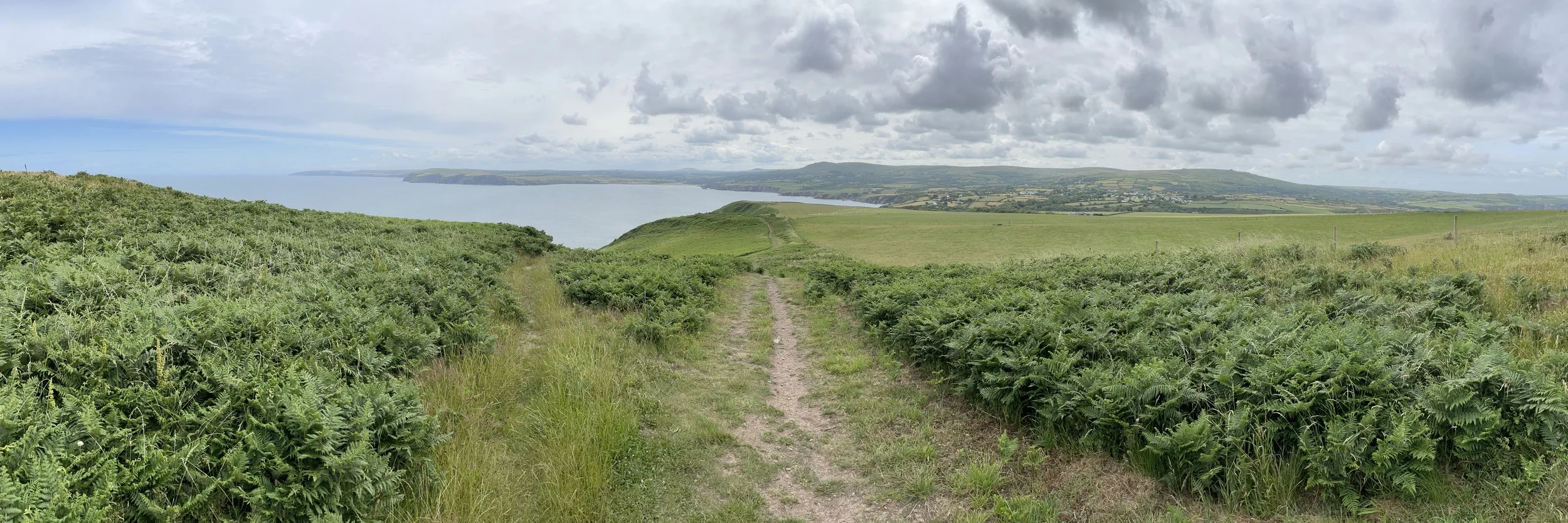
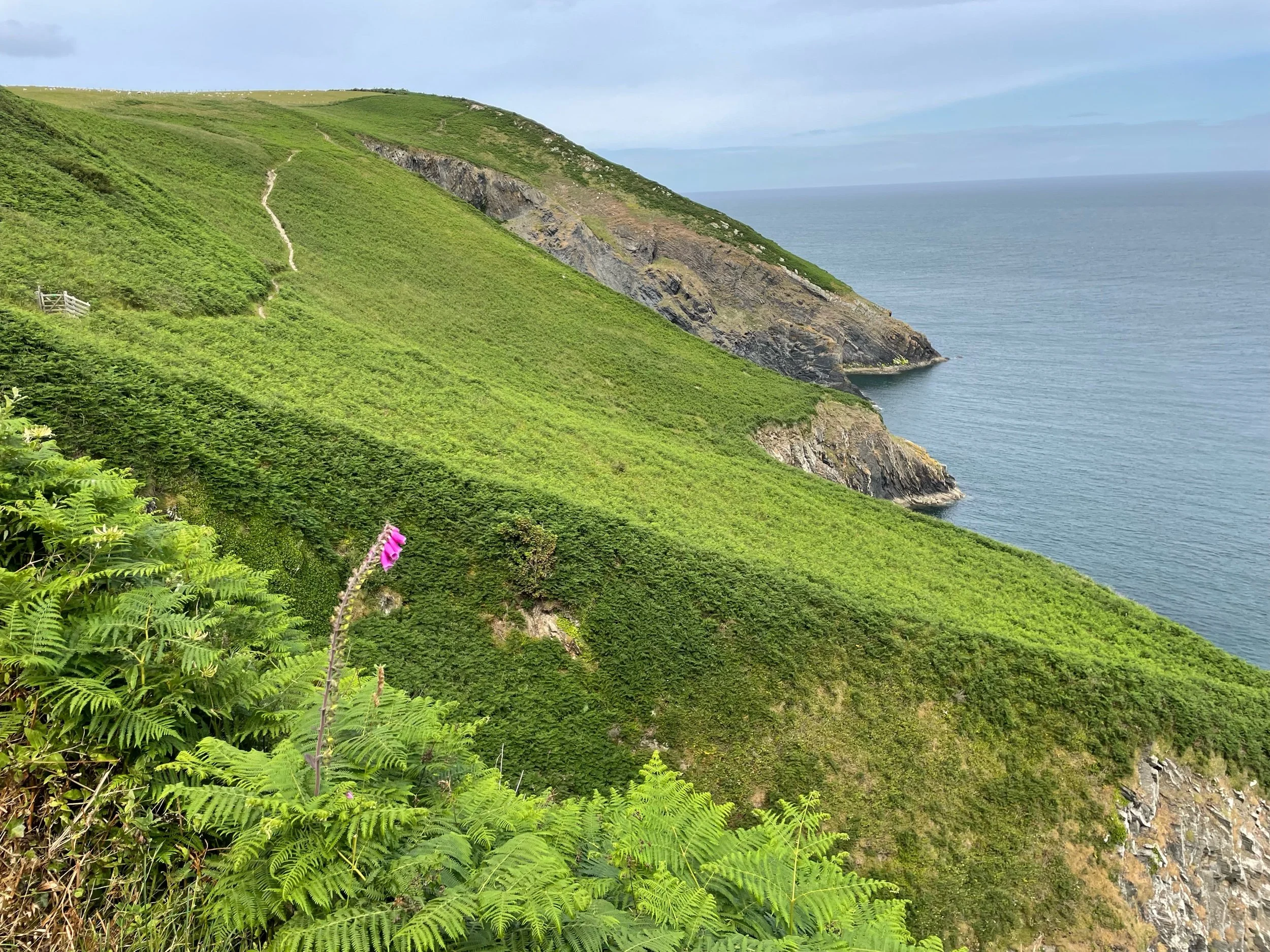
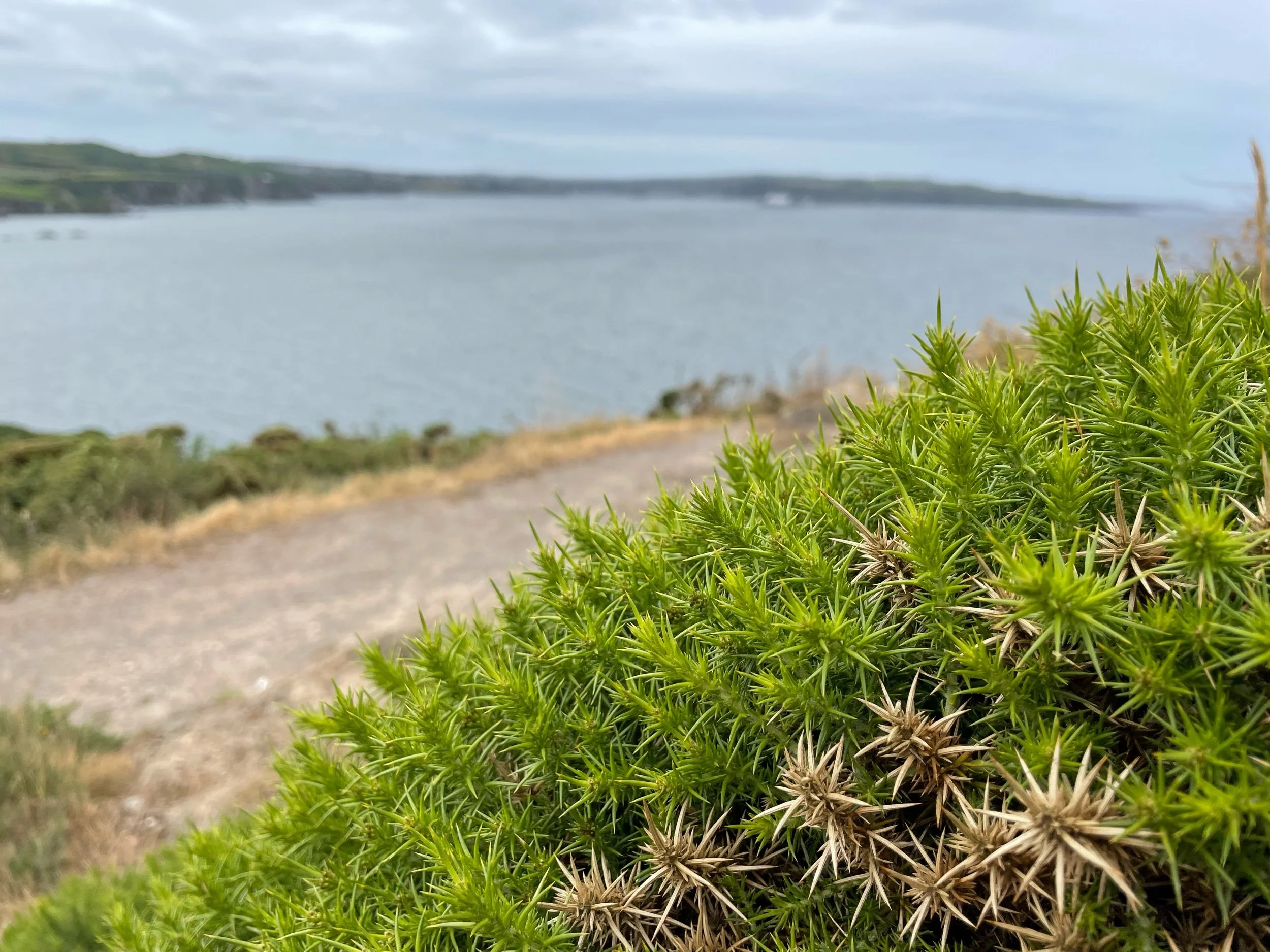
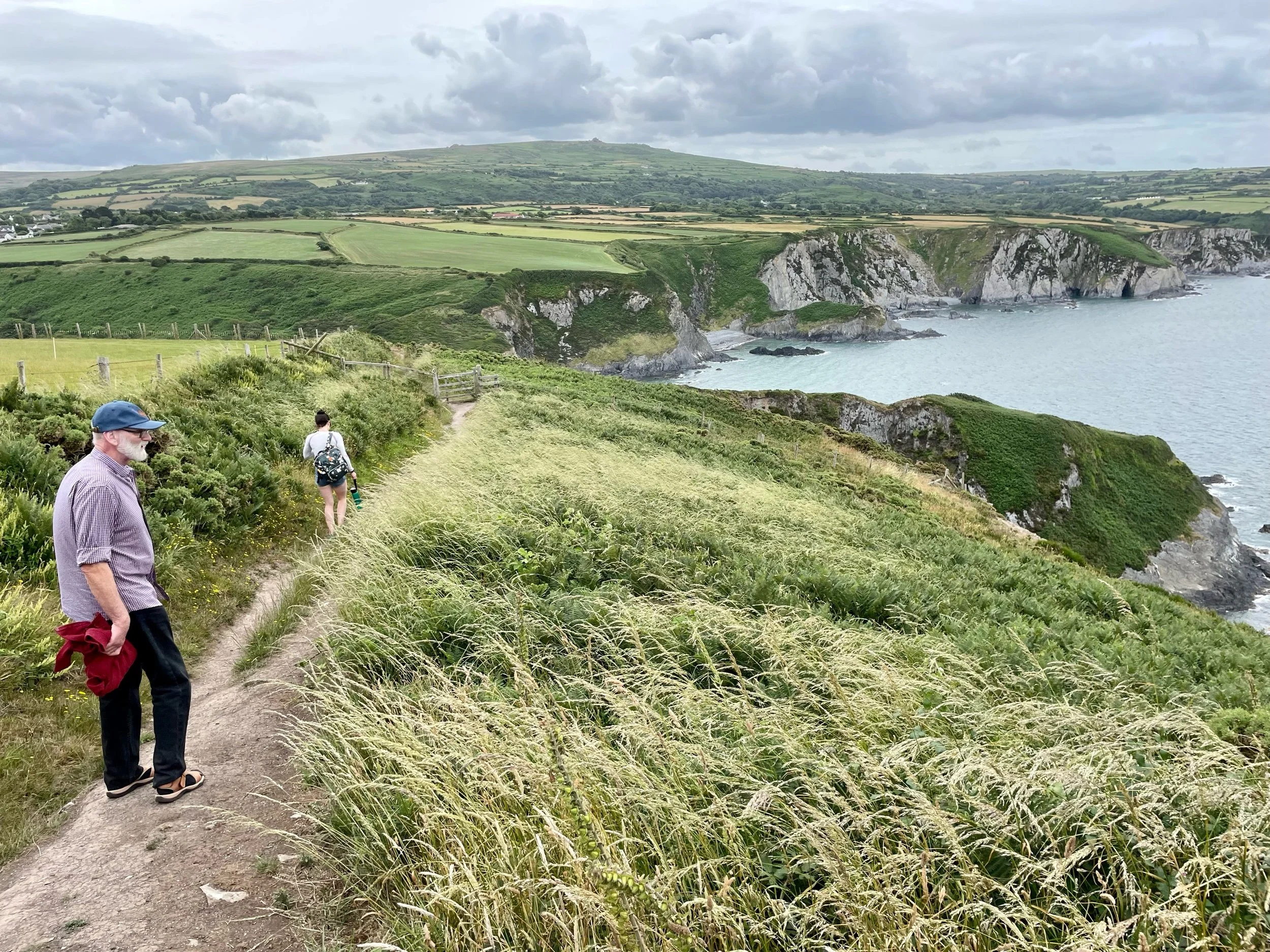
The climb was definitely worth it though. A few minutes later, we were up on open heathland, the ferns up here a more normal height, fronds tickling your kneecaps as you brushed by. From here we had a panoramic view out to sea and along the coastline. The path clung to the side of the hills and cliffs, although it looked as if it may have been moved inland once or twice over the years as the wind and salt water had satiated its appetite for land, nibbling its way steadily into Wales.

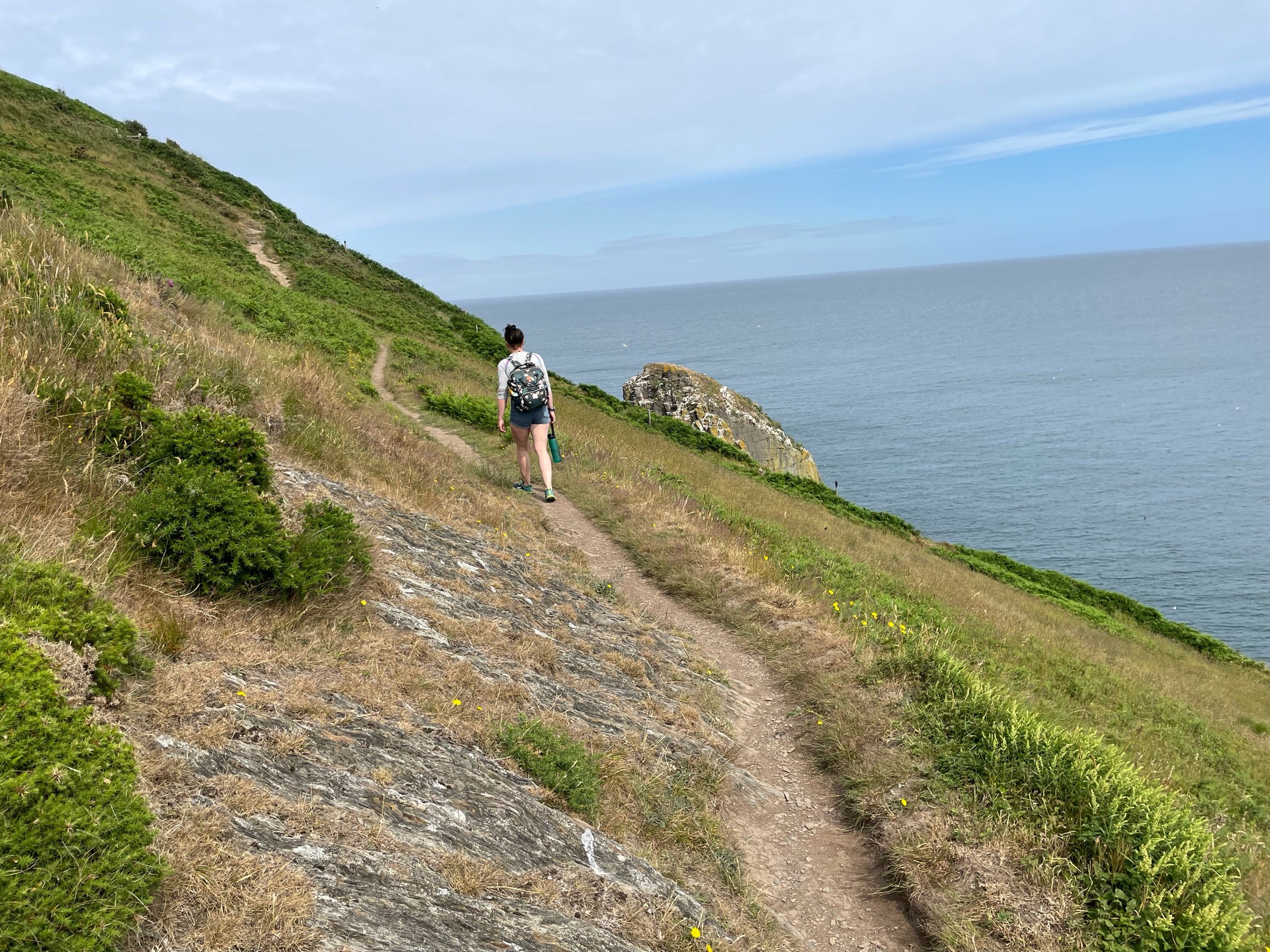
A little way along, Needle Rock towered upwards just a few metres out to sea. The stack was inhabited by thousands of nesting gulls and black and white sea birds, possibly razorbills or guillemots. A lack of binoculars and ornithology skills means I can’t confirm which. It could well have been both. The noise was deafening, the seabirds cackling like a coven of witches as we trod the path carefully towards the rock.

The birds nesting and chatting up on Needle Rock.

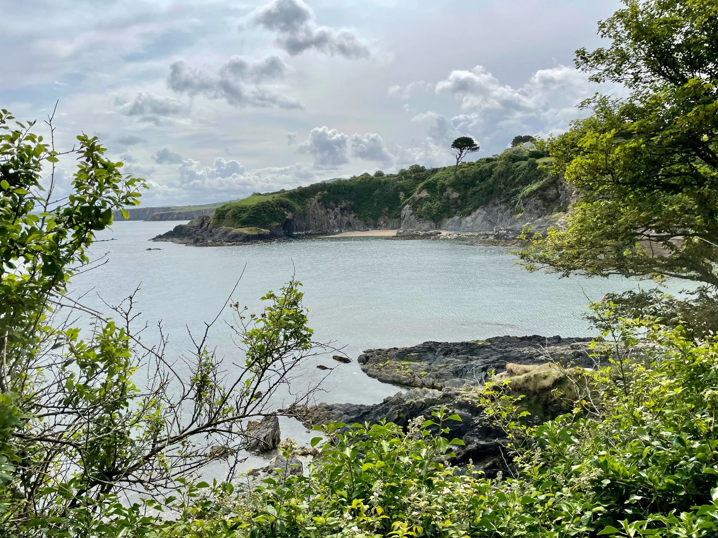
Past Needle Rock, the path continued to climb until we reached the summit and the furthest point of the headland at Pen y Fan. At 142 metres it’s not quite as high as its famous mountain cousin of the same name in the Brecon Beacons (now known by their traditional Welsh name, Bannau Brycheiniog), but it still offers fantastic views eastwards back towards Needle Rock, which now, from above, looks more like a tiny pimple, and west across Fishguard Bay to its eponymous ferry port. (Pen y Fan, by the way, means something along the lines of ‘top of this place’, hence why you’ll find quite a few of them around Wales.)

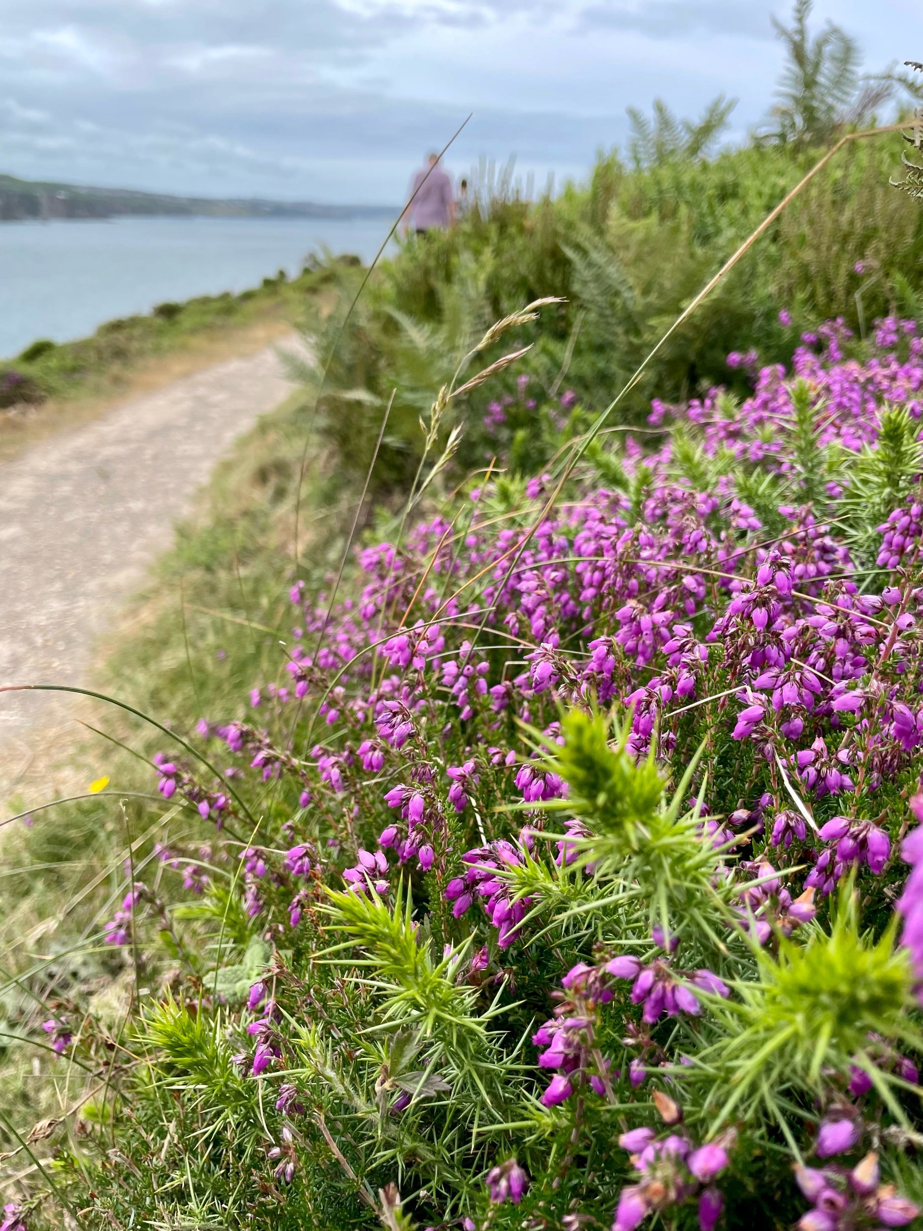
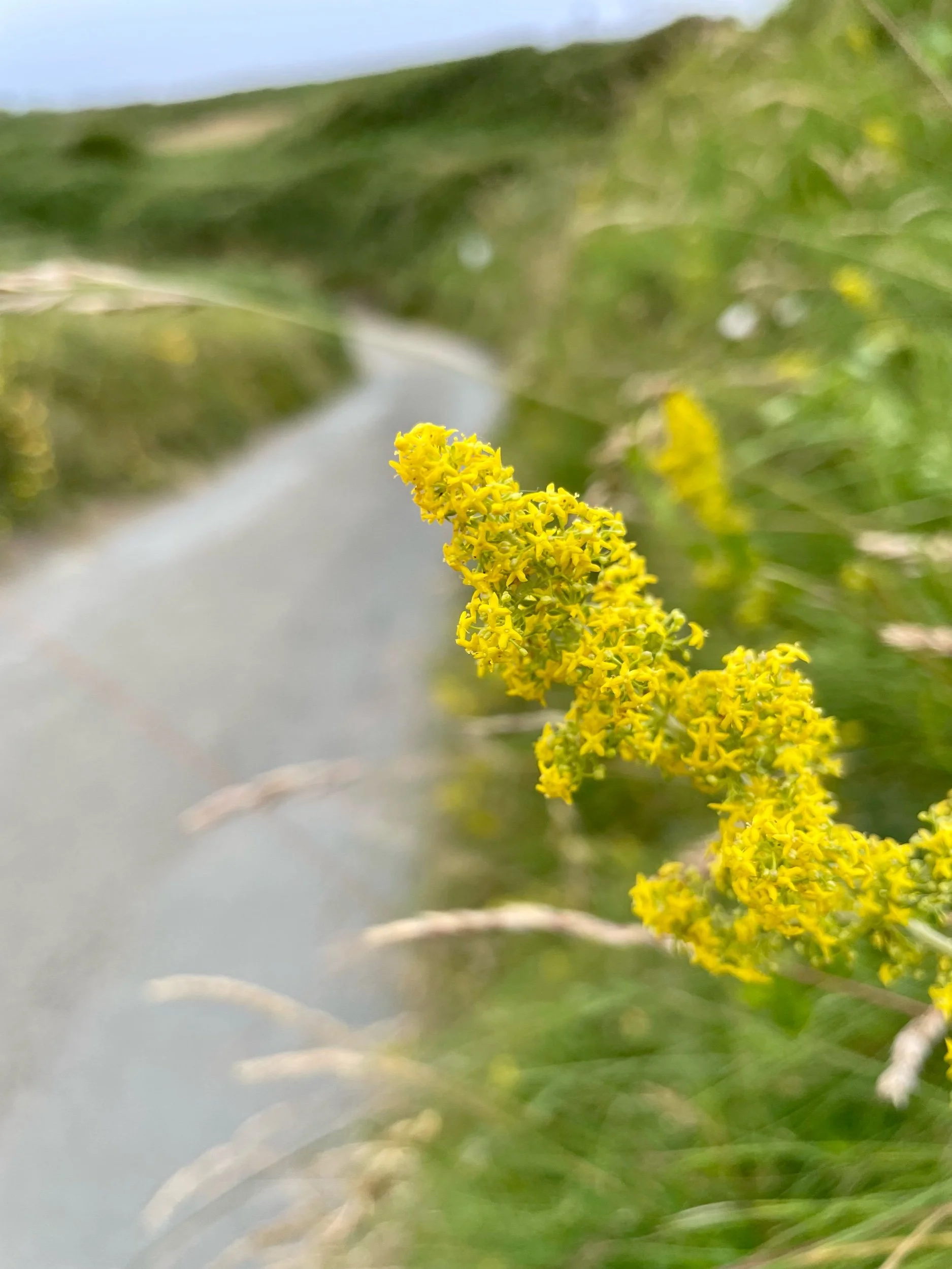
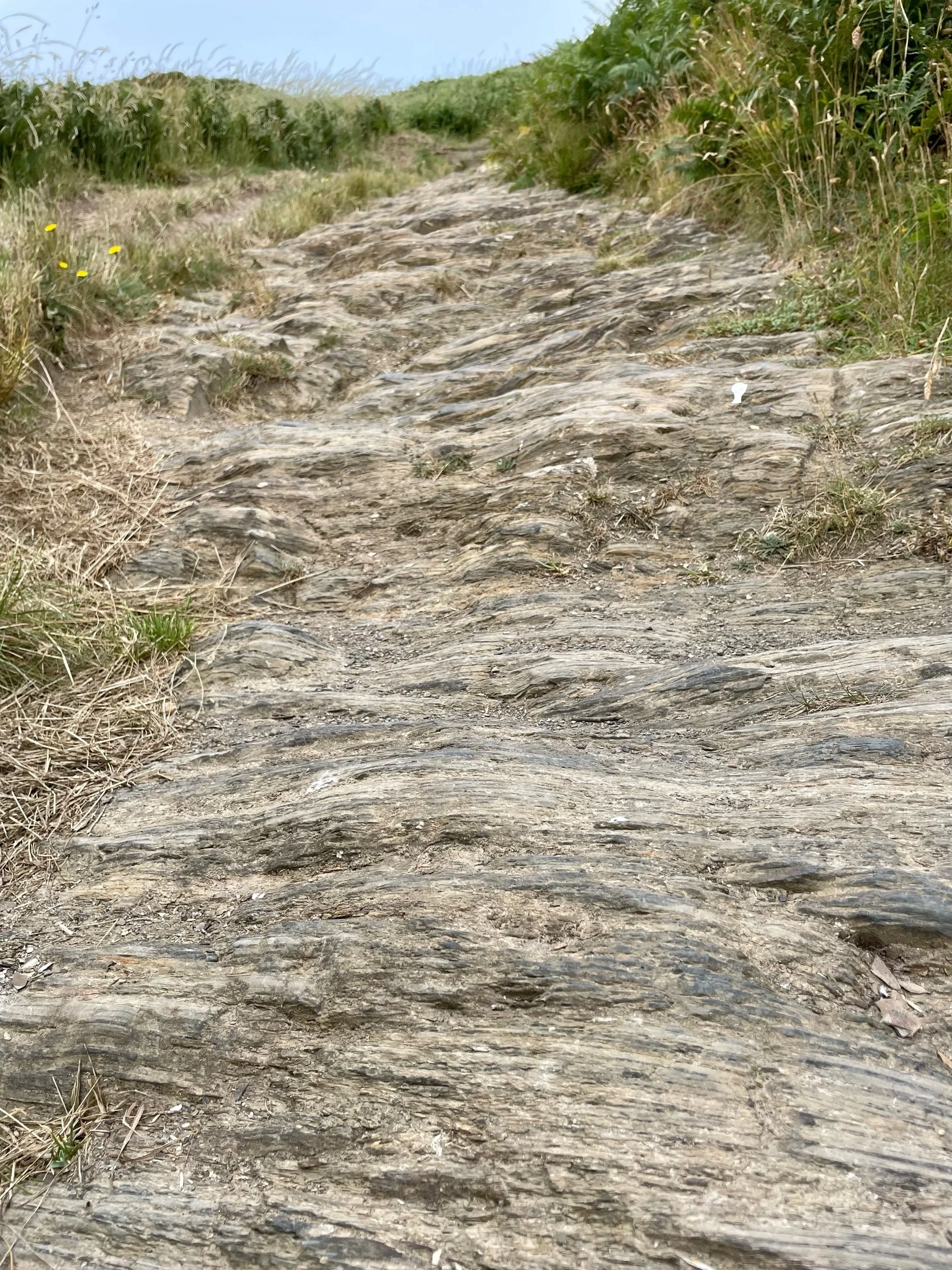
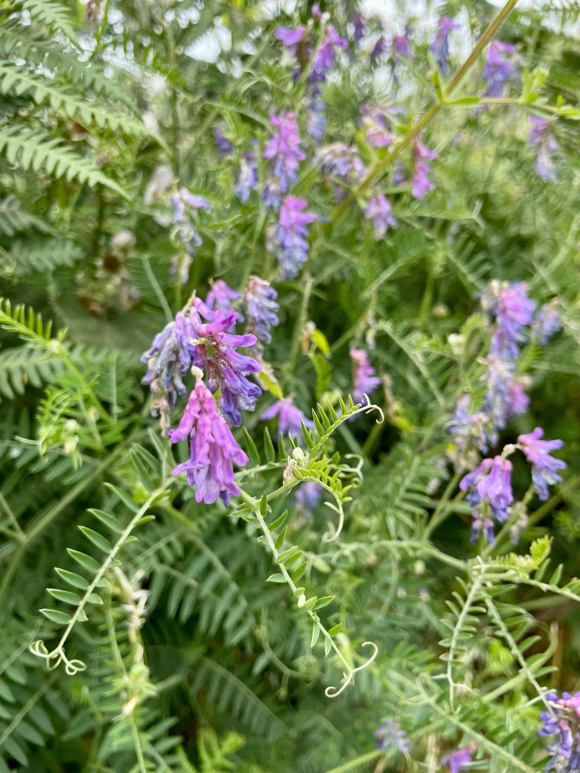
The descent to Pwllgaelod began gently but became steeper as the path wore down into the earth until we were walking on the jagged bedrock. An array of flowers added colour to the journey, thrift; vetch; scabious; clover; heather; and plenty more I didn’t know.

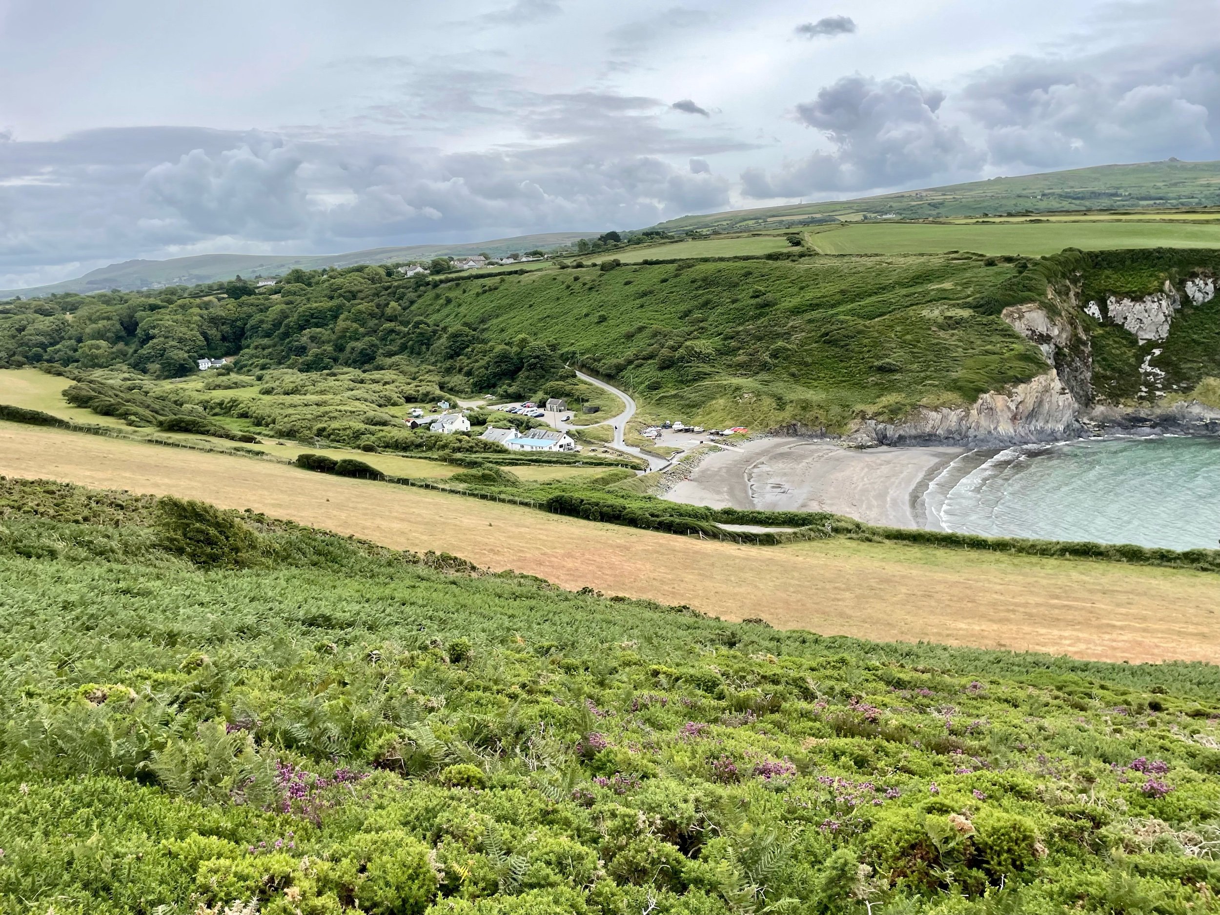
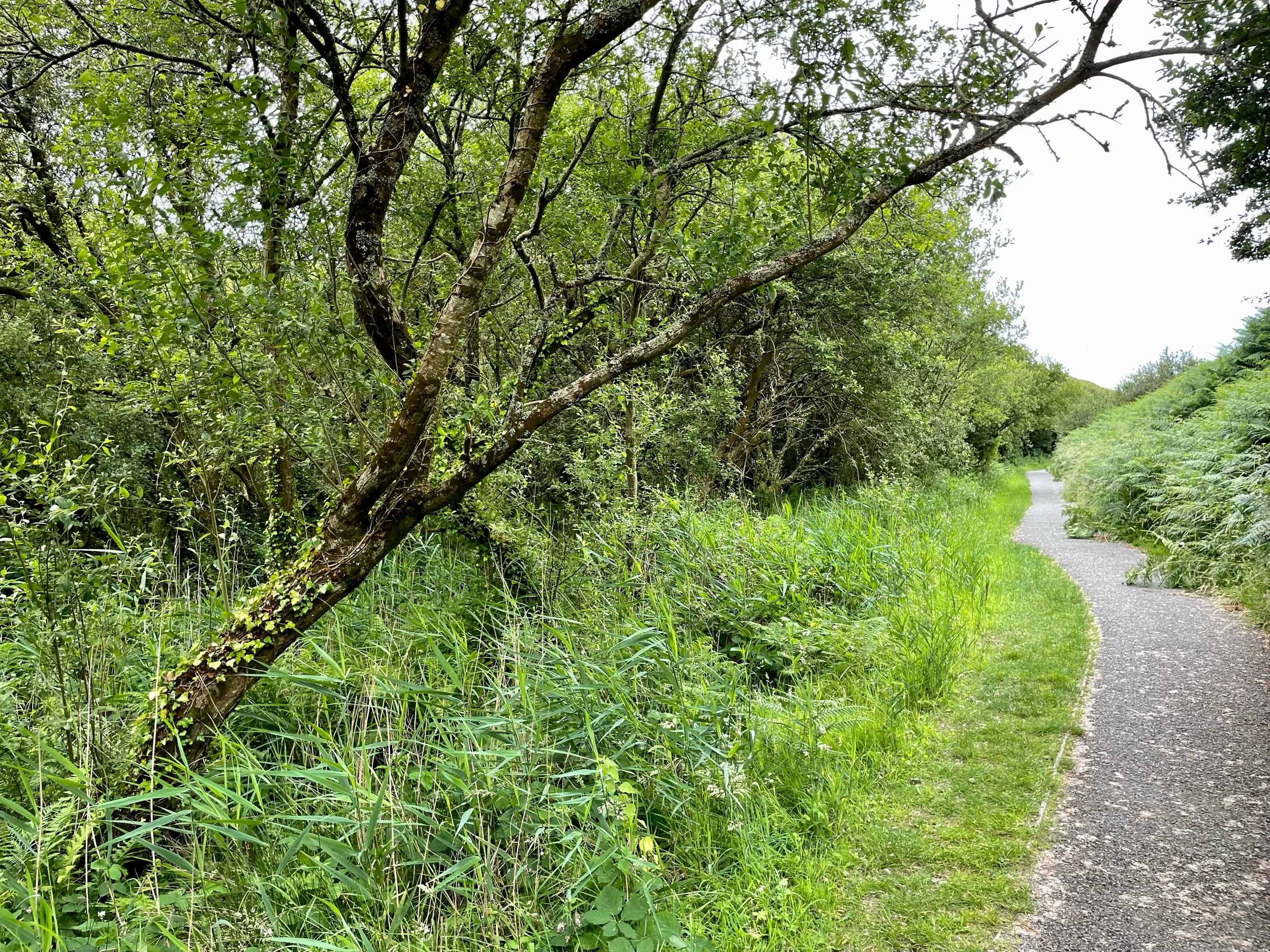
Pwllgwaelod is another cracking little cove with a great beach, pub/cafe and toilets if you fancy some refreshments after your efforts. From here, it’s a short and easy walk back along a flat, tarmac path that tucks behind Dinas Island through an ancient wet woodland. I wondered if this marshy area was once much wetter and effectively cut off the headland, making it an island of sorts, hence its often-used alternative name.

We were soon back in Cwm-yr-Eglwys, completing the circle feeling satisfied but peckish, so we jumped in the van and headed up the coast into Cardigan to find some lunch. By the time we returned, the car park was full, proving that, even outside of holiday time, the early bird catches the parking space.

Walk notes

  • The road down to Cwm-yr-Eglwys is steep and very narrow. Parking was £5 via an honesty box but there were public toilets and what looked like a little kiosk that might sell drinks and ice creams. It was closed when we were there though. Having researched a little more since our walk, it appears that the car park at Pwllgwaelod on the other side of the headland is currently free of charge. With the toilets and pub/cafe, you might find it much better to start the loop from that side and finish with some well-earned refreshments.

  • The path is steep and with several steps out of Cwm-yr-Eglwys. Up on the headland, it gets narrow in sections with some big drops off the cliff edge, so care is required. Sections on the other side of the headland to/from Pwllgwaelod are also steep and uneven in parts.

Further reading

A wheelie wonderful weekend in Wales

Click here to sign up to our newsletter and get weekly help to get fitter, healthier and happier

The drive from Bristol to Wales on Thursday afternoon gave us a good indication of what was to come in the days ahead. The sun shone down from on high, intense and uninterrupted, not a cloud in the sky to stifle its powerful rays even for a second. After leaving the motorway, we wound through the farmland and rolling hills of Worcestershire, Herefordshire and Shropshire before crossing the border into Wales. Quiet villages full of crooked, centuries old buildings lined the route, interspersed by farmland, rivers, forests and panoramic hilltop views.

We arrived into Newtown in late afternoon and after dropping Sam at her B&B, Vicky, Brian and I headed for our cottage. What greeted us was stunning, a collection of beautifully refurbished farm buildings surrounding the main house, a lake complete with fountain and even a couple of highly inquisitive llamas. A quick spot of unpacking and off into town to greet the arriving riders, get some dinner and watch England play Belgium. Unusually, we weren't too fussed by the latter because somehow we'd already won our first two games and qualified, so the debate was more about whether we wanted to win to maintain momentum, or lose and possibly get into the easier side of the draw (which as it turns out, we definitely did). After a short briefing on the first day's ride over dinner, everyone headed off for an early night ahead of the first day of cycling.

IMG_2558.jpg
IMG_2561.jpg

Day 1

By 8:30 the following morning, our group of riders had amassed outside the Elephant & Castle Hotel in Newtown. The sun was shining, it was already warm and after a few bike tweaks, a little air in the tyres and the usual remembering someone had forgotten something, they were off. Brian and Simon rolling out on the front to pace everyone sensibly, Tom roving in the middle to ensure everyone was ok and Vicky at the rear ensuring nobody took a wrong turn and that everyone was supported. It was my turn to drive the van and I was excited to experience a day supporting in the Transporter. There's an official balance one on the way later this year so we'd hired one for this trip and I was keen to see how useful it would be. Turns out, it's amazing!

IMG_2564.jpg

The route wound along the valley on a quiet B road for 15 miles, following the river and surrounded on all sides by green hills. It was a pleasant and steady start for the group and it didn't seem long before they'd made it over the first hill of the day to the water/feed stop in the market town of Llanidloes (roughly and poorly pronounced, Thlan-id-loice). Out of town and there was more climbing to do, this one long and in full sun but with great views of the valleys between the green peaks we were climbing. Driving along to catch up with the front riders, it appeared that the locals had decided to run a scrambling bike race on either side of the road, meaning that the riders had to join the main road and travel along for a good mile or two before continuing the race on the other side. With their race heads on, some were taking great risks cutting corners on the main road and I was pleased to hear Brian had given one of the organisers a piece of his mind. There's a lot of information in Brian's mind I might add, so I am sure the guy felt all the wiser for it!

The vast majority started their descent down into the town of Rhayader and I headed back to help with the first mechanical issue of the day, a faulty inner tube valve, which was causing Alex's tyre to constantly deflate. Vicky had waited for him so once we'd replaced it with a new one, they were off again. Tom had kindly waited for them in Rhayader so that they could work together on the climb into the Elan Valley. I drove off to head for a rendezvous-vous with the others at the lunch-stop but was quickly called back when Vicky rang to say her bike had broken. The hanger holding the rear mech (the thing that makes the gears change on the back cog) had snapped and it was unridable so she jumped in the van and Tom and Alex headed off again. Luckily there was a bike shop with the right parts literally round the corner and with Brian's mechanical expertise, she was able to get up and running again and ride as support crew on the Sunday.

Out of Rhayader and the road climbs at a constant but challenging gradient of around 8-10 per cent towards the Elan Valley. Built in the early 20th century, the dams that line the valley form a series of lakes that control the flow down from on high and still supply Birmingham with water to this day. Before the dams were built, the land was occupied by two large manor houses and a few small villages. All are now lost beneath the waters but you can discover more about them and their connection to the famous poet Percy Shelley, at the Elan Valley Visitor Centre. Once you reach the top of the climb, you enter a breath-taking moon-like landscape of heath, rivers and lakes. You can only imagine what it is like on a cold, windswept winter day; you probably don't want to know for real. But cycling around it in glorious sunshine is well worth the effort of the climb, and you're rewarded with a winding Alpine-like descent along the dam edges as you breeze effortlessly down towards the visitor centre.

A quick lunch stop at the visitor centre and it was time to head north again, briefly following the main road before cutting across onto a National Cycle Route that hugged the river. We topped up everyone's water and energy levels in the quaint little town of Llangurig and I opted to jump on my bike and accompany Alex and Tom for the last leg of the day. It was a real treat as I'd expected to be in the van all day but Vicky was keen to drive it too so it worked perfectly. Simon, Brian, Laura, Jason, Graham, Sam and Oliver set off just ahead of us and after another short, sharp climb up to the ridge-line, we reached a series of wind turbines. You'll find them dotted across the hills and mountains of mid-Wales and they're an awe-inspiring site, so huge in their construction and capable of a somewhat eerie sound as they're propelled around by an invisible force. The road back down the other side was completely traffic-free and we rolled along enjoying the views, seemingly a million miles away from the thoughts of daily life. No emails or calls to answer, no meetings or deadlines, just the scenery to enjoy and the hypnotic revolution of the pedals all the way back to base.

That evening we dined in the pub as a group and I handed out the awards for the day, the title of which are never decided until the day itself. Laura and Alex took the honours on this occasion, Laura for pushing Brian and Simon to ride harder than they'd expected with some great hill-climbing, and Alex for ensuring his bike suffered multiple mechanicals so that he could deliberately spend longer out on the road enjoying the beautiful countryside.

Day 2

Another sunny day lay ahead and this time we took a short drive to Llanidloes to commence the day from there. Vicky was on van duties today and I'd warned the group we faced a challenging start with a few big hills right from the off. I'd also said that their efforts would be rewarded with some stunning views and that was definitely the case. The day started with a blanket of cloud and after two steady climbs and speedy descents, we reached the Clywedog Reservoir, the tallest dam of its kind in the UK. It was amazing to think that the water we were seeing today and yesterday would flow over 100 miles downhill along the rivers Severn and Wye until it passed just a short distance from our house on its way out to sea. 

Birds of prey flew overhead, their imposing wingspans making it easy to imagine we'd travelled to a far-flung land that time had forgotten. In fact, as we climbed past Dylife onto the Plynlimon escarpment, part of the Cambrian mountains, Oliver remarked that other than the beautiful tarmac edged on both sides by bright white paint, there was almost no evidence that human beings existed at all. Not a building, pylon or man-made structure in sight. Instead we were greeted with jaw-dropping views of steep-sided gorges that would not look out of place in Jurassic Park and as we reached the top of the 3-mile climb, a panoramic of the mountains surrounding us, whilst in the distance lay the imposing peaks of Snowdonia. The descent into Machynlleth was joyous, rolling for mile after mile with barely a pedal turn, the only work to do to steer the bike when the occasional cross-wind gusted through the barren landscape. 

We descended the last mile into town, passing the links-style golf course, expect that this one lay at the foot of a mountain rather than on a windswept coastline. Over the cattle grid marking the return to civilisation, we regrouped for a feed stop in the bustling market town. Graham and Sam remarked that they were glad we'd come down that long descent instead of up it, and their expressions were one of surprise (and I suspect secret excitement) at the news I gave that we were indeed going back over it on the way home. 

Refreshed and refuelled, I offered the group the choice of routes to reach our lunch destination; a quieter road through a hilly forest or a flatter but more main road that hugged the estuary flowing into St George's Channel, which connects the Irish Sea to the Celtic sea further south. Whilst there would doubtless be a few more cars, my promise of less ups and downs and unforgettable scenery meant they opted for the latter. I was delighted as my recce just a few weeks before had revealed a road that hugged the coastline, with only one of the most daring railroads built in the UK separating us from the azure blue water. The sun was now shining through strongly again and that coupled with the pine forests to our right and the way the light reflected off the water to our left and we could have just as easily been descending down into Monaco as heading for the fishing village of Aberdovey. 

The miles ticked by in joyous calm until we reached our lunch stop. Aberdovey's brightly coloured houses and coffee shops sit opposite a small grassy park with views across the tightly packed masts of fishing boats and out to sea. It was a perfect to stop for sandwiches and pizza to balance out our morning exertions, contrasting so sharply with the wild mountaintop we'd been on just a few miles before.

One of the challenges of taking people to such beautiful places is getting started again, so after a leisurely lunch we headed north along the coastline and into Snowdonia. This was actually to be the flattest part of our day, taking a pass that ran alongside Tal y Llyn lake at the foot of the giant imposing figure of the mountain, Cadair Idris, all 2,930 feet of it. I'd hoped the group could rest up along here, enjoy the views and regroup before a reasonable climb and another long descent back into Machynlleth. It doesn't always work like that of course and instead we had to battle through a headwind. The support crew did their jobs, sitting at the front of each mini-group and allowing some relief for everyone. The climb to Corris didn't seem too long, or maybe it just felt short in comparison to what was to come, and soon we were gently descending to Machynlleth, back over the 300-year old stone bridge and enjoying tea and cake in the mid-afternoon sun. 

The biggest challenge yet lay ahead, nearly eight miles of climbing back over the Cambrian Mountains. As I rode alongside Simon, I quietly whispered that it was a brute of a climb, before dropping back to take up my position at the rear of the group. Long climbs on a bike are as much a mental challenge as they are physical. Dropping through the gears allows respite for your legs, but it also means it takes longer. Jason, Laura, Tom, Simon and Brain pushed off into the distance and Oliver, Graham, Sam and I remained fairly close together behind. The road starts at a fairly steady incline but as you near the top there are some steep sections and the effort shown by all was tremendous. It's a weird feeling when you're moving uphill, pedals sometimes revolving so slowly you're not sure they're still turning. Many wrongly assume that only the super-fit can do it, but as long as you have the right gears, a willingness to try and a little practice behind you, you can make it. One of the real joys I get from our events is the look on people's faces when they achieve something they were unsure they could.

IMG_2775.jpg
IMG_2779.jpg

It took us nigh on an hour to crest the mountain, but after more food and water, we descended the shorter side the wind in our faces and then turned off for a flatter route home, skirting the edge of the hills through the Hafren Forest in the dappled light of late afternoon, just above the banks of the the source of the River Severn. Legend has it that Hafren was a princess of ancient Britain and drowned in these waters, giving rise to the Welsh name for the forest and the longest river in Britain. Back in Llanidloes the group celebrated their achievements with a refreshing beverage and a few pub snacks.

Everyone headed to our converted barn later that evening, including Laura's husband Michael who'd joined us in Newtown and taken the chance to explore the mountains by foot and bike with their amazing dog Charlie sat in the basket whilst he pedalled, and we enjoyed fish and chips with a beer or a glass of wine overlooking the lake. Jason took the prize for the day for his timekeeping skills, but as it was the last time we'd all ride as a group with Alex, Oliver and Graham heading home the next day, everyone received their ride awards, specially designed beer or wine glasses with a little reminder of the importance of balance.

IMG_2856.JPG

Oliver has mentioned to me on more than one of our rides how everyone who comes along is always great fun and easy to get along with, and he noted how the nature of the events themselves were self-selecting; people who like people, like to challenge themselves but also don't like to take it too seriously and to balance out the hard work with great food and the odd drink. As we always say, the social side is as important as the exercise. We want you to come away feeling physically tired but mentally reinvigorated and refreshed.

Day 3

With long journeys home back to reality, everyone agreed they wanted to ride the shorter route on the final day. Setting out this time from the quaint Norman castle town of Montgomery, the staging post of many a border battle in times past, we acted like true Celtic soldiers and invaded England, the border just a mile or so to the east. I was back in the van today, Brian having done a grand repair job on Vicky's bike, borrowing a few parts from mine in the process. 

The group moved along at a fair lick and after catching up with Oliver, Graham and Alex for a farewell coffee in the town, I caught them up just before the only real climb of the day. They refuelled and headed up on to the Long Mynd, the most famous of the Shropshire Hills. More stunning scenery, more remote and peaceful roads to ride, this time the Portway, an ancient trackway that traverses the ridge line. Passing the glider club, the group descended a very steep road, up to 25% in places, before quiet lanes led them to Bishop's Castle for a well earned drink and snack. We timed it well as we ended up in the middle of the summer fair, enjoying an eclectic procession of carnival floats and vintage farm vehicles. After that, all that was left was a quick 10 miles back to the start and our long weekend was complete.

A balanced weekend

All in all, it was a perfectly balanced few days. Quiet roads in beautiful scenery, great company, lovely food and a good challenge. I realised over the course of the weekend that it's wrong to classify these weekends as events, they're more like mini-breaks; social occasions built around getting away from the hustle and bustle of life for a few days to make friends, challenge yourself, get a bit fitter in the process and find your balance.

Look out for our full schedule for next year coming in early September. We'll have more day and weekend rides and walks than ever before and a range of distances and challenge levels to suit everyone. We'll also be linking up with local charities so you can help others whilst pushing yourself, getting fitter, healthier, happier and finding your balance.

Sign up to our newsletter and be the first to know when we launch new events and breaks